
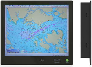
Electronic Chart Display and Information System
The Electronic Chart Display and Information System (ECDIS) is a customized digital navigation computer that provides an alternative to traditional paper charts and meets the requirements of the IMO.
This system stores Electronic Navigation Charts (ENCs) and/or Raster Charts that present all relevant geographic data necessary for a crew to navigate a voyage.
Compared to traditional navigation tools, ECDIS charts often integrate more comprehensive data and automate various essential functions.
Learn more about PC Maritime’s Electronic Navigation Charts or contact us at commercial@belgamarine.com.br.